---------------------------------
Address
Phone: +251 988 111 222
Need help or have a question?
Contact us at: info@driveethiopia.com
Addis Ababa, Ethiopia
---------------------------------
Address
Phone: +251 988 111 222
Need help or have a question?
Contact us at: info@driveethiopia.com
Addis Ababa, Ethiopia


How much it rains in Ethiopia from June to September, station by station, which regions work under current FCDO advice, and why the Omo is between rains.
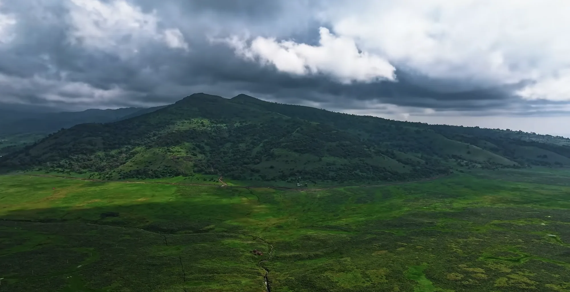
June to September is the kiremt, the main rainy season across Ethiopia's central and northern highlands. It does not cover the whole country. On FEWS NET's seasonal calendar the southern pastoral areas, which take in the lower Omo Valley, have no rainy season at all in those months. The Rift Valley lakes and Bale get less than half the July rain that Addis Ababa does. The catch for anyone planning around a fixed summer holiday is the north. The places most often sold as "green season" draws, Lalibela, Gondar, Bahir Dar and the Simien Mountains, are all in Amhara region, and the UK Foreign Office advises against all travel there (page updated 30 October 2026).
So a June to September trip is workable, but it is a southern and central trip. This guide shows how much rain falls where, what the official advice says for each region, and what the season gives you in return.
Not at the moment. The Simien Mountains are in Amhara region, and the FCDO advises against all travel to Amhara. That is the answer for August, and for every other month while the advice stands. We would not book a Simien trek for you under it.
Weather is the second reason, not the first. Gondar, the nearest of the Meteorological Institute stations published by the WMO, averages 275 mm of rain in August on the Ethiopian Meteorological Institute's 1981 to 2010 normals. Our Simien trekking guide covers the route for a later year, and the Lalibela safety page explains how we read the Amhara advice and what would have to change.
The figures below are monthly averages for 1981 to 2010, published by the Ethiopian Meteorological Institute through the World Meteorological Organization's World Weather Information Service. A rain day there means any day with 0.1 mm or more, so a brief afternoon shower counts the same as a wet day.
| Station | July rain | August rain | Rain days in August | Share of the year's rain falling June to September |
|---|---|---|---|---|
| Bahir Dar | 396 mm | 375 mm | 28 | 84% |
| Gondar | 293 mm | 275 mm | 21 | 81% |
| Lalibela | 240 mm | 260 mm | 22 | 70% |
| Addis Ababa | 280 mm | 290 mm | 26 | 74% |
| Jimma | 269 mm | 273 mm | 25 | 57% |
| Dire Dawa | 115 mm | 158 mm | 14 | 53% |
| Hawassa | 128 mm | 125 mm | 20 | 45% |
| Bale Robe | 105 mm | 121 mm | 20 | 44% |
Two things stand out. The northern stations take most of their year's rain in these four months, so the season there is short and intense. Hawassa and Bale Robe get less than half of Addis Ababa's July total and spread their rain more evenly through the year, with a second peak in spring.
There is no station in the table for the lower Omo. For the far south we use FEWS NET's Ethiopia seasonal calendar, which puts the southern pastoral rains in March to May and October to December. June to September falls between them.
The FCDO column quotes the advice page as updated on 30 October 2026. Advice changes in weeks, so check the FCDO Ethiopia page again before you book.
| Region | Rain pattern, June to September | What it means on the road | What the season gives you | FCDO position, 30 Oct 2026 |
|---|---|---|---|---|
| Lower Omo Valley and Konso | Between the two southern rainy seasons | The unsurfaced tracks are in their dry window | The south's own dry season | Advises against all travel within 10 km of the borders with South Sudan and Kenya, including the shores of Lake Turkana. No other warning for the area |
| Rift Valley lakes, Hawassa | Moderate. About 125 mm a month in July and August | Mostly tarmac along the main corridor | Green lakeshore country | The A7 from the Addis Ababa to Adama expressway down to Hawassa is excluded from the East Shewa warning |
| Bale Mountains | Moderate, wetter on the high plateau | Slower, and cold at altitude | Green moorland and forest | No advice against travel. Notes demonstrations have taken place in Bale zone |
| Addis Ababa | Heavy. Rain on most days in July and August | City roads stay in use | Festivals in September | No advice against travel |
| Southwest, Jimma and Kafa | Heavy and long, the wettest station in the table | Forest roads are slow | The forest at its most lush | No advice against travel in Jimma or Kafa |
| East, Dire Dawa and Harar | Moderate, peaking in August | Most visitors fly to Dire Dawa | Lower annual rainfall than the highlands | Reports attacks on vehicles on the A1 between Adama and Awash, and tensions in Haraghe zones |
| Amhara: Lalibela, Gondar, Bahir Dar, Simien | Heavy, most of the year's rain | Not relevant while the advice stands | Not relevant while the advice stands | Advises against all travel to Amhara region |
| Tigray | Kiremt rains | Not relevant while the advice stands | Not relevant while the advice stands | Advises against all travel to Tigray region |
| Afar, including the Danakil | Lowland heat, not rain, is the limit | Not relevant in this window | Not relevant in this window | Advises against all but essential travel to most of Afar, and all travel near the Eritrean border and the Tigray boundary |
The "what it means on the road" column is our reading of the rainfall figures, not a measured road condition. Roads close for reasons that have nothing to do with weather, so we confirm the route with you before departure.
If your dates are fixed in July or August, this is where we would point you. The lower Omo Valley, Konso and the country around Arba Minch sit between the southern rains, and the roads that fail there in the wet season are the unsurfaced tracks between Jinka, Turmi and the market villages. In these months they are in their dry window.
Our Omo Valley tour covers that ground, and the Omo Valley guide explains how visits to Hamar, Mursi, Karo and Dassanech communities work, including the payment structure for photographs. The 7-day southern itinerary shows how the days fit together.
Two health points from the FCDO page belong in your planning. Malaria is common up to 2,000 metres above sea level, and much of the south lies below that. The FCDO also reports an ongoing cholera outbreak in the south of Ethiopia, which makes its advice to drink only boiled or bottled water and avoid ice more than routine. Talk to a travel clinic before you go.
The lakes south of Addis Ababa are the gentlest version of the season. Hawassa averages about 125 mm in each of July and August, less than half of the capital's total, and the main road south is the corridor the FCDO carves out of its East Shewa warning. The FCDO notes protests in several Oromia towns, Shashemene among them, so we watch local news on that road. Our Rift Valley lakes guide covers Ziway, Langano, Abijatta-Shalla and Hawassa.
Bale Robe, on the northern edge of the Bale Mountains, takes a similar amount of rain. The Sanetti Plateau above it is higher, colder and wetter than the town, and our Bale Mountains guide still recommends October to March for the plateau. A summer visit is possible if you accept cold, wet days at altitude in exchange for a park that is green to the horizon.
The capital is wet. On the Meteorological Institute's normals it averages 280 mm in July and 290 mm in August, with rain on 27 and 26 days. The city keeps working, the museums are indoors, and a car with a driver takes most of the sting out of getting between them. Addis Ababa also sits at about 2,400 metres, and the FCDO lists altitude sickness as a risk there, so give yourself a slow first day.
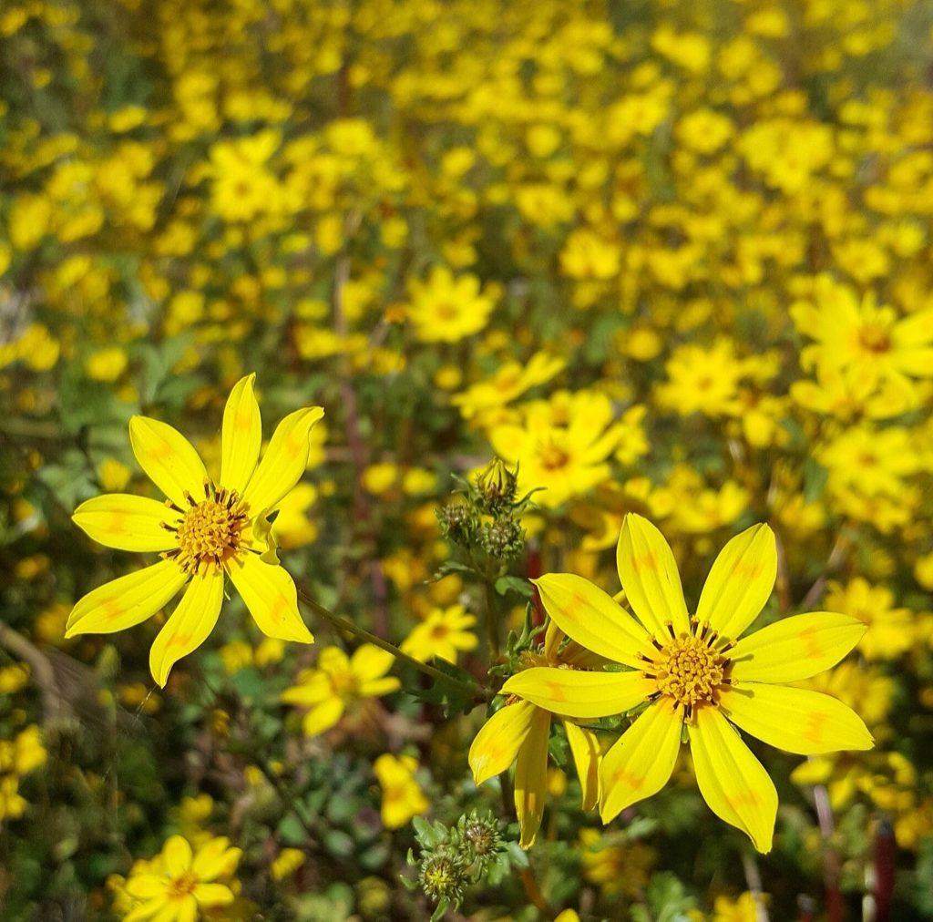
The last weeks of the season are the easiest to sell, because the rain tails off and the calendar fills. Enkutatash, the Ethiopian New Year, falls on 12 September in 2027. Meskel falls on 28 September 2027, with the demera bonfire lit in Meskel Square in Addis Ababa on the eve, 27 September. Our festival calendar explains why both dates are a day later than usual that year.
The yellow Meskel daisies, adey abeba, flower across the highlands at this time, and they give the New Year its look. Because Meskel's main event is in the capital, it is the one festival of the year you can plan without leaving Addis Ababa. Our Meskel guide for Addis Ababa covers the square, the eve and where to stand.
Leave daylight for the drive. The FCDO advises avoiding driving after dark anywhere outside Addis Ababa, because vehicles often have no lights and livestock stray onto the road. Shorter driving days matter more when an afternoon storm slows the last stretch.
Expect gaps in signal. The FCDO says mobile networks are not consistent or reliable, and that the authorities may close them without notice. Download offline maps and leave your itinerary with someone at home.
Pack for two climates, because you will meet cool, wet highland days and warm lowland ones on the same trip. Our packing list covers both.
Keep the north for a later year. When the advice on Amhara changes, the dry months there are October to March. We track the advice on our Lalibela and Tigray safety pages. Our best time to visit guide has the full month-by-month picture.
Not while the current advice stands. The Simien Mountains are in Amhara region, and the FCDO advises against all travel to Amhara (page updated 30 October 2026). August is also one of the wettest months there, with Gondar averaging 275 mm on the Ethiopian Meteorological Institute's 1981 to 2010 normals.
The southern pastoral areas, including the lower Omo Valley. FEWS NET's seasonal calendar puts their rains in March to May and October to December, so June to September falls between them. The Rift Valley lakes and Bale are not dry, but they get less than half the July rain of Addis Ababa.
About 280 mm on average, with rain recorded on 27 days of the month, on the 1981 to 2010 normals the Ethiopian Meteorological Institute publishes through the WMO. A rain day counts any day with 0.1 mm or more, so many of those days are showers rather than washouts.
On rainfall, yes. July sits between the southern rainy seasons, so the unsurfaced tracks around Jinka and Turmi are in their dry window. The FCDO advises against all travel only within 10 km of the borders with Kenya and South Sudan, and it reports an ongoing cholera outbreak in the south, so take its water advice seriously.
Enkutatash, the Ethiopian New Year, on 12 September 2027, and Meskel on 28 September 2027, with the bonfire in Meskel Square on the evening of 27 September. Both dates are a day later than usual in 2027 because of how the Ethiopian leap year falls.
If your holiday is fixed in June, July or August, send us the dates and what you want to see. We will reply within two hours and send a detailed itinerary with a quote within 24 hours, built around the regions where the season and the current advice both work. Contact us here, or browse our Ethiopia tours first.
