---------------------------------
Address
Phone: +251 988 111 222
Need help or have a question?
Contact us at: info@driveethiopia.com
Addis Ababa, Ethiopia
---------------------------------
Address
Phone: +251 988 111 222
Need help or have a question?
Contact us at: info@driveethiopia.com
Addis Ababa, Ethiopia


Erta Ale volcano trek: what the records say about the lava lake since 2025, how the night climb works, and the FCDO advice on Afar as of October 2026.
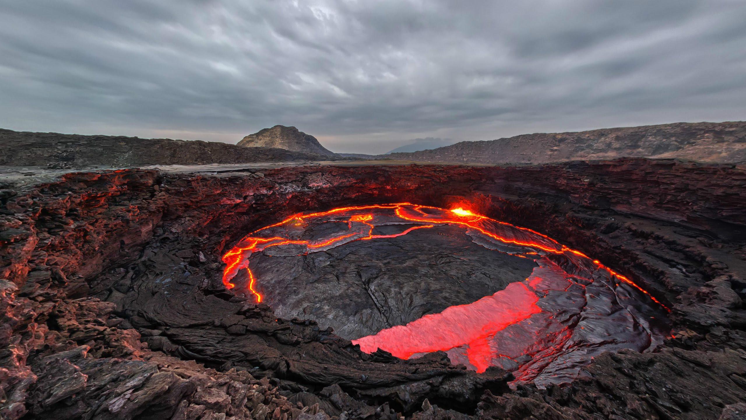
Erta Ale is a shield volcano in Ethiopia's Afar Region, and the trek to its summit caldera is a short night walk over old lava from a base camp reached by 4×4 through Dodom village. The famous lava lake is the part that has changed. The Smithsonian Global Volcanism Program records the eruption that kept it alive since 1967 as ending on 7 August 2025, and lists no eruption since (database read 26 October 2026). So go for the crater and the walk across the lava fields, and treat glowing lava as a possibility rather than the plan.
Access has also changed. As of the UK Foreign Office (FCDO) update of 21 October 2026, it advises against all but essential travel to most of Afar, and says foreign nationals currently cannot travel to airports in the region. This guide covers what the volcano is like now, how the climb works, and what to check before you commit.
The Global Volcanism Program describes Erta Ale as a basaltic shield volcano with an edifice 50 km wide, rising more than 600 metres from below sea level in the Danakil Depression. Its summit sits at 585 metres. At the top is a summit crater of about 0.7 by 1.6 km holding steep-sided pit craters, and southeast of it lies a larger depression, about 1.8 by 3.1 km, bounded by fault scarps.
GVP's photo notes call it the most active volcano in Ethiopia. For most of the last six decades it was also one of the very few places on Earth where you could look down into a long-lived lava lake. GVP's summary says the caldera usually held at least one, active since at least 1967 and possibly since 1906.
The volcano lies in the Afar Region, in the northern part of the Danakil, the low rift basin that also holds Dallol and the salt flats of Lake Assale. The Afar people live and work across this whole region, and the salt trade you see on the flats is theirs.
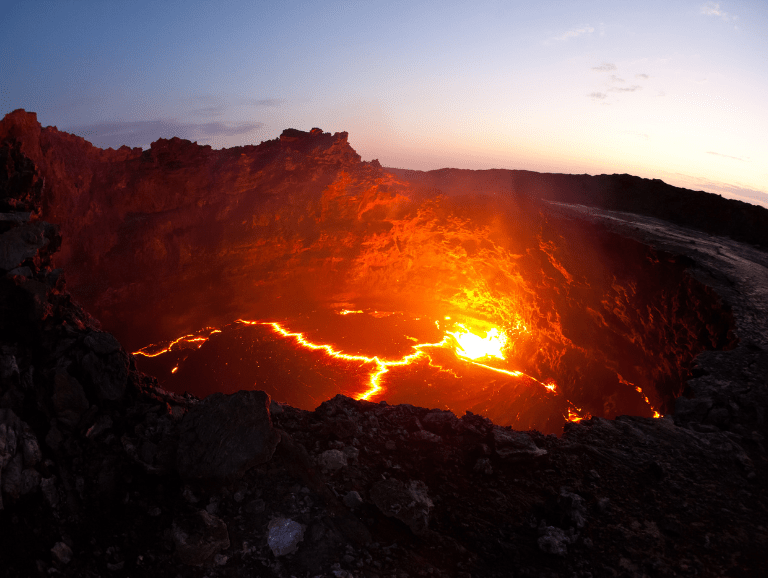
This is the question most people searching for Erta Ale want answered, and photographs online will mislead you, because most were taken before 2025.
The Global Volcanism Program records the sequence like this:
| Date | What GVP records |
|---|---|
| 2 July 1967 | Start of the long-running eruption that sustained the lava lake |
| 7 August 2025 | End date GVP gives for that eruption |
| 25 November 2025 | Satellite imagery after the 23 November eruption at nearby Hayli Gubbi showed ashfall across Erta Ale and a new collapsed area in the northern caldera, about 685 by 385 metres, with white plumes rising from both pit craters |
| 26 October 2026 | GVP's eruption database lists no Erta Ale eruption after 7 August 2025 |
An eruption being "ended" in GVP's records does not make the volcano quiet or safe to wander. It means the long phase of continuous activity, the one that produced the lava-lake photographs, is no longer counted as ongoing. What you see from the rim depends on the state of the craters on your night, and nobody can promise it weeks ahead.
That has a practical consequence when you compare trips. Any tour description that still promises a "permanent lava lake" is describing the volcano as it was. It is a fair question to ask any operator, including us, when their information was last checked. Our own guide to the Hayli Gubbi eruption covers the November 2025 event next door.
The standard format has three parts, and none of them involves technical climbing.
From the Afar lowlands the route crosses sand and cooled lava fields by 4×4 to a base camp below the summit. On our own itinerary you stop at Dodom village on the way, which is also where the authorisation to ascend Erta Ale is presented. The permit is arranged as part of the tour rather than something you sort out on the day.
You climb in the evening, as the heat drops. The path crosses old lava, which is uneven and sharp enough to cut skin and shred cheap soles. The ground is the difficulty here, not the gradient. Walking speed is set by the slowest person and by the light from head torches.
Groups spend time at the caldera after dark, sleep at basic camp, and usually go back up at first light for a second look before the heat returns. Then the day continues by vehicle towards Hamad Ela, Lake Assale and Dallol.
We have deliberately not given clock times or a walking duration. Published figures for the distance from Dodom to the summit and for the length of the walk disagree with each other. Your operator should give you the timings for the route they actually drive.
The Danakil is one of the hottest inhabited places on Earth, and Erta Ale trips are built around avoiding the middle of the day. Operators generally run the route in the cooler months, roughly November to February. Our Danakil Depression guide explains why heat, not terrain, is the real limit, and our health guide covers heat illness and what to discuss with a travel clinic.
Visits run under the authorisation presented at Dodom, with local scouts as part of the arrangement.
Our packing list for Ethiopia has a full desert section.
Expect simple shelters or sleeping outside, no running water and very limited toilets. People who know that in advance usually enjoy it. People who expected a lodge do not.
The honest answer depends on your route and on the date you read this. The FCDO wording below on Afar comes from its Ethiopia advice updated 21 October 2026 and checked on 26 October 2026.
The FCDO "advises against all travel to within 20km of the border with Eritrea", "advises against all travel to within 50km of the boundary with Tigray region", and "advises against all but essential travel to the rest of Afar."
Where Erta Ale sits within that. Measured on OpenStreetMap boundaries from the summit coordinates GVP publishes, the volcano is about 86 km from the Tigray boundary and about 54 km from the Eritrean border. So it is outside both "all travel" strips and inside the "all but essential" part of Afar. That is still advice against a holiday visit, and it can affect your travel insurance.
Three other lines from the same advice matter for this trip:
The advice also notes "irregular armed clashes between ethnic groups in Afar region and Somali Regional State, in particular along the main Addis Ababa to Djibouti road (A1)", which matters for any overland approach from Addis Ababa.
Put together: as of late October 2026, both standard flight routes into an Erta Ale trip are closed to most foreign visitors, and the volcano sits in an area under advice against all but essential travel. Read the FCDO Ethiopia advice yourself before booking, check your insurer's position in writing, and ask any operator exactly how they would get you in and out.
Erta Ale is almost never a stand-alone visit. It is one night of a Danakil circuit that also covers Lake Afdera, the salt flats around Lake Assale where Afar workers cut salt blocks, and the mineral terraces and acid springs of Dallol. You can see the shape of that circuit, as we have run it, on our Danakil Depression tour page.
If you are still deciding whether the Danakil belongs on your trip at all, our comparison of Lalibela, the Simien Mountains and the Danakil sets the three side by side.
Not one anybody can promise. The Smithsonian Global Volcanism Program records the eruption that sustained the lava lake from 1967 as ending on 7 August 2025, and its database listed no eruption since when checked on 26 October 2026. In November 2025 a new collapse formed in the northern caldera. What is visible on any night depends on the craters at the time.
It is a walk, not a climb. The challenge is the ground: uneven, sharp old lava crossed in the dark by head torch. Anyone who walks comfortably on rough paths and copes with heat can usually manage it. Thick-soled shoes matter more than fitness.
Yes. On our itinerary, the authorisation to ascend Erta Ale is presented at Dodom village on the drive in to the base camp. It is arranged as part of the tour, and visits run with local scouts.
No. Measured on OpenStreetMap boundaries from GVP's summit coordinates, it is about 86 km from the Tigray boundary, outside the FCDO's 50 km "all travel" strip. It is about 54 km from the Eritrean border, outside the 20 km strip. It sits in the part of Afar where the FCDO advises against all but essential travel.
Not at the moment, according to the FCDO's advice of 21 October 2026. It says foreign nationals are currently unable to travel to airports in Afar, which includes Semera, and that all civilian flights to and from Tigray, which includes Mekele, are suspended. Check the current advice before you book.
The cooler months, roughly November to February, when operators generally run the Danakil route. Outside that window the heat is the limiting factor. Whatever the month, check the travel advice and the volcano's recent activity close to your dates.
Erta Ale rewards people who go with the right expectations: a hot drive, a rough walk in the dark, a basic camp and a crater whose mood you cannot book in advance. Right now the bigger question is access, and that changes faster than any volcano.
We are running Danakil and Erta Ale trips. Because the flight routes above are closed to most foreign visitors, the route depends on the advice in force when you travel. We confirm it, along with what you can currently expect to see at the crater, when you enquire.
Tell us your dates and what you want to see in the Danakil. You will have a reply within two hours and a detailed itinerary with a quote within 24 hours, including how we would route it under the advice in force at the time. Send us your trip details.
