---------------------------------
Address
Phone: +251 988 111 222
Need help or have a question?
Contact us at: info@driveethiopia.com
Addis Ababa, Ethiopia
---------------------------------
Address
Phone: +251 988 111 222
Need help or have a question?
Contact us at: info@driveethiopia.com
Addis Ababa, Ethiopia


Sof Omar is Ethiopia's longest cave: 15.1 km of passage cut by the Web river in Bale. What is inside, why it is sacred, and what to bring on a visit.
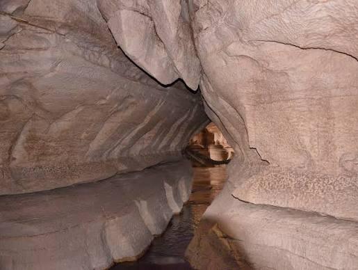
Sof Omar is Ethiopia's longest known cave. Surveyors have mapped 15.1 km of passage under a gorge in the East Bale Zone of Oromia, cut through limestone by the Web river on its way down from the Bale Mountains. When a British expedition finished that survey in 1972, it was the longest cave known in Africa. It no longer is. Caves in Madagascar and Algeria have since been mapped longer.
It is also a sacred site. The caves are holy in local Islamic practice, through the holy man Sheikh Sof Omar who gave them his name, and in Oromo traditional religion, whose ties to the place are older.
To visit, you need a local guide and your own torch, and you will wade the river where the path crosses it. This guide covers what is down there and why the place matters to the people who live beside it. For the practical side of the trip, see our Sof Omar Caves destination guide.
The surveyed figure is 15.1 km. That number comes from three expeditions, each adding to the last:
| Year | Who | What they added |
|---|---|---|
| 1890s | Arthur Donaldson Smith, American explorer | First written account of a visit, published in 1897 |
| 1967 | Eric Robson, Chris Clapham and Kabir Ahmed | About 8 km of passage explored and surveyed |
| 1971 | Théodore Monod, Bill Morton and Ato Mezmure Hailemeskale | About 1 km of new passage |
| 1972 | British expedition including Dick Ramsden and Dave Catlin | 6.1 km of new passage, taking the total to 15.1 km |
You will also see "more than 15 km" and rounder figures quoted. They all trace back to the same 1972 survey. A 2015 study in the Journal of African Earth Sciences, on how the caves formed, uses 15.1 km as well and calls Sof Omar the longest cave in Ethiopia.
So the honest answer to "is it Africa's longest cave?" is that it was, for a while. Today it is Ethiopia's longest.
The Web river, also written Weyib and once mapped as the Gestro, rises in the Bale Mountains and flows east. At Sof Omar it disappears into the rock at an entrance called Ayiew Maco. It comes back out at the Holuca resurgence, a little over a kilometre downstream.
That short distance is the surprise. The river covers about a kilometre on the map, yet the cave around it holds 15 km of passage. The water does not run in one straight tunnel. It braids through a maze of chambers, side passages and dry galleries.
The 2015 study explains why. The caves sit in Jurassic limestone, in a layer about 20 m thick, sandwiched with thin beds of marl and mudstone. Uplift and stretching during the East African rifting, in the mid-Miocene, cracked the rock and set off collapse along those bedding planes. Water then widened the cracks and chambers over a very long time. The authors also found that many of the dry passages are older than the river's present course. The Web moved into spaces that were already forming, and enlarged them.
On the surface, the gorge looks like a wide, shallow hollow with the old river channel cut through its middle. On the basalt plateau above, there is a collapse hole about 100 m wide and 60 m deep.
The caves have 42 entrances, but only four are of practical use. Two Village Entrances sit upstream, east and west of the village. The Tourist Entrance lies downstream of the Holuca resurgence. A fourth, on the right bank below Holuca, leads into a section the surveyors named Clapham's Climb Series.
Most visits follow the river from the Tourist Entrance. The names on the survey map are worth knowing, because guides use them:
The caves also hold bats, studied at Sof Omar in 1971 by researchers from Haile Selassie University, along with cave fish and small crustaceans.
The caves and the village beside them take their name from Sheikh Sof Omar, a Muslim holy man who, by local tradition, lived here and took refuge in the caves. His daughter was Ayiew, and the upstream entrance carries her name. In the local language, "maco" means name and "holuca" means cave.
Sof Omar is sacred to Oromo traditional religion as well as to Islam, and the religious history of the place is said to run back before Islam reached Bale. The 2015 study notes that the caves are still central to the cultural and religious life of the people who live around them. A shrine used by local people stands near the Village Entrances.
That changes how you should visit. This is a living religious site, not only a geological one.
Sof Omar is on Ethiopia's UNESCO Tentative List, the register of sites a country plans to nominate for World Heritage status. It was submitted on 14 December 2011 under the name "Holqa Sof Omar: Natural and Cultural Heritage", which recognises both sides of the site together. It has not been inscribed. Our guide to Ethiopia's UNESCO World Heritage Sites covers the sites that have.
| What you need | Why |
|---|---|
| A local guide | Local guides lead visits and carry copies of the British survey maps. With 42 entrances, a river and no lighting, this is not a cave to enter alone. |
| Your own light | There is no artificial lighting in the caves. Bring a headtorch and a spare light source, with fresh batteries. |
| Shoes that can get wet | The path crosses the river at the fords. Wear closed shoes or sturdy sandals with grip that you are happy to soak. |
| Quick-drying clothes | You will wade. Leave jeans behind. |
| A dry bag | For your phone, camera and passport. |
| Modest dress | It is a sacred site. Shoulders and knees covered. |
Water level is the one thing that can stop a visit. The river floods in the rains, and the mud marks in the Chamber of Columns show how far it climbs. Ask your guide about the river on the day. If they say it is too high, it is.
We could not find a current, official entry or guide fee, so we do not quote one here. Ask your operator to confirm what is payable on site.
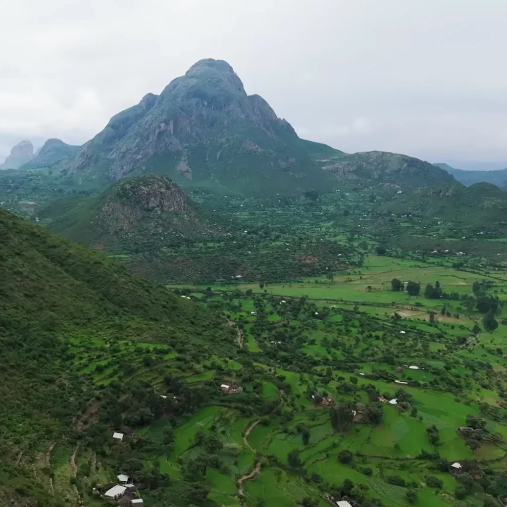
Sof Omar lies east of the town of Ginnir in the East Bale Zone of Oromia, and the usual approach is from Goro. It is a long way east of the Bale Mountains National Park, and most travellers who make the trip combine it with the park. Our guide to the Bale Mountains and the Ethiopian wolf covers that side of the region.
The UK Foreign, Commonwealth and Development Office (FCDO) updated its Ethiopia advice on 16 October 2026. As of that date:
Read the current advice before you book and again before you travel, because it changes. Your route out of Addis Ababa matters as much as the destination.
Sof Omar is not part of our published itineraries as standard. It fits best as an addition to a Bale itinerary, such as our Ethiopia nature tours or birding and wildlife tours, both of which spend several days in the Bale Mountains. We plan tailor-made routes, so we can build the caves into either.
If you would rather plan your own route, a car with a driver leaves you free to watch the road instead of driving it. For more places off the standard northern circuit, see our guide to lesser-visited places in Ethiopia.
No. It was the longest known cave in Africa when it was surveyed in 1972, but caves in Madagascar and Algeria have since been mapped longer. It is still the longest known cave in Ethiopia, at 15.1 km of surveyed passage.
It is sacred to both Islam and Oromo traditional religion. The caves are named after Sheikh Sof Omar, a Muslim holy man who by local tradition took refuge there, and the site's religious use is said to be older than the arrival of Islam in Bale. A shrine stands near the village entrances.
Yes. The caves have 42 entrances, an active river and no lighting. Local guides lead visits using copies of the British survey maps.
Yes. The route follows the Web river and crosses it at fords, so expect to wade. Wear shoes and clothes that can get soaked, and keep your phone and passport in a dry bag.
In the East Bale Zone of Oromia, south-east Ethiopia, east of the town of Ginnir. The usual approach is from Goro, and most visitors combine the caves with the Bale Mountains National Park.
One of the largest chambers in the Sof Omar system. It is filled with limestone columns, the tallest about 20 m high, and mud marks on its walls show how high the river floods in the rainy season.
Sof Omar rewards the effort, but it takes planning. The river level decides the season, and the current travel advice decides the route.
Tell us your dates and what you want to see. You will have a reply within two hours and a detailed itinerary with a quote within 24 hours. Send us your enquiry.
