---------------------------------
Address
Phone: +251 988 111 222
Need help or have a question?
Contact us at: info@driveethiopia.com
Addis Ababa, Ethiopia
---------------------------------
Address
Phone: +251 988 111 222
Need help or have a question?
Contact us at: info@driveethiopia.com
Addis Ababa, Ethiopia


Ethiopia's endemic birds sit mostly on a southern loop from Addis. Where to go, the months that are dry at both ends, and which zones carry advisories.

Ethiopia's endemic birds are concentrated in the south, and you can reach most of them on a single loop out of Addis Ababa. The usual route runs east to Awash National Park, then south down the Rift Valley past Lake Ziway and Lake Abijatta-Shalla, up into the Bale Mountains, and on into the acacia country around Yabello and Mega. Drive Ethiopia's own birding itinerary covers that ground in 14 days, with three of them in Bale.
Two things about that trip are worth settling before you book. The first is timing, because the window quoted in almost every article is highland timing, and the southern half of the route runs on a different rainfall calendar. The second is which regions currently carry travel advisories, because the northern endemic sites sit inside one and the southern sites mostly do not.
Published answers run from sixteen to more than thirty, and hardly any of the pages giving a number explain why they disagree with the page above them in the results. Two things cause the spread.
Field guides usually treat Ethiopia and Eritrea as one region, because several restricted-range species straddle the border. A count of "Ethiopian endemics" in the low thirties is normally a count for both countries. A count in the high teens or low twenties is for Ethiopia alone.
The rest is taxonomy. Several Ethiopian populations sit inside the long-running argument about what counts as a full species, and each checklist resolves a few of them differently. Checklists built on Avibase's Ethiopia data put the national total at 880 confirmed species with 20 endemics as of August 2021. Operator pages quoting "over 860" and "more than 920" are both drawing on something real. They are counting different things. The two most used current checklists both put the figure at 22, and our checklist of Ethiopia’s endemic birds lists each species with its habitat, best site and easiest months.
For planning a trip the number matters less than the map. Nearly everything people fly to Ethiopia to see sits in a handful of places, and those places are mostly south of Addis.
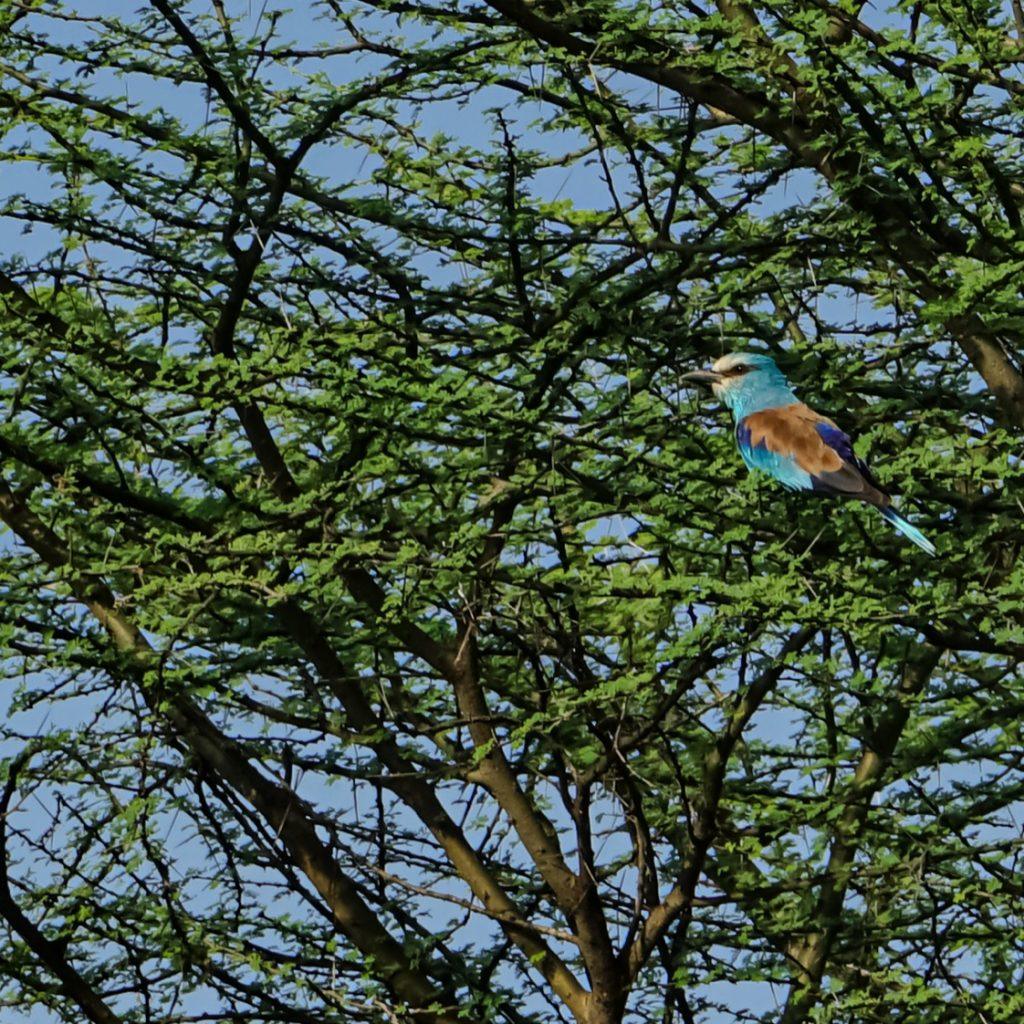
Awash sits east of Addis on the A1, the road to Djibouti, and it is the nearest place to the capital with genuine dry-country birds. Acacia scrub and open plains give you bustards and coursers that never turn up in the highlands, and the gallery forest along the Awash river adds a different set again. It is also the one leg of the loop where the FCDO has something specific to say about the road itself, covered further down.
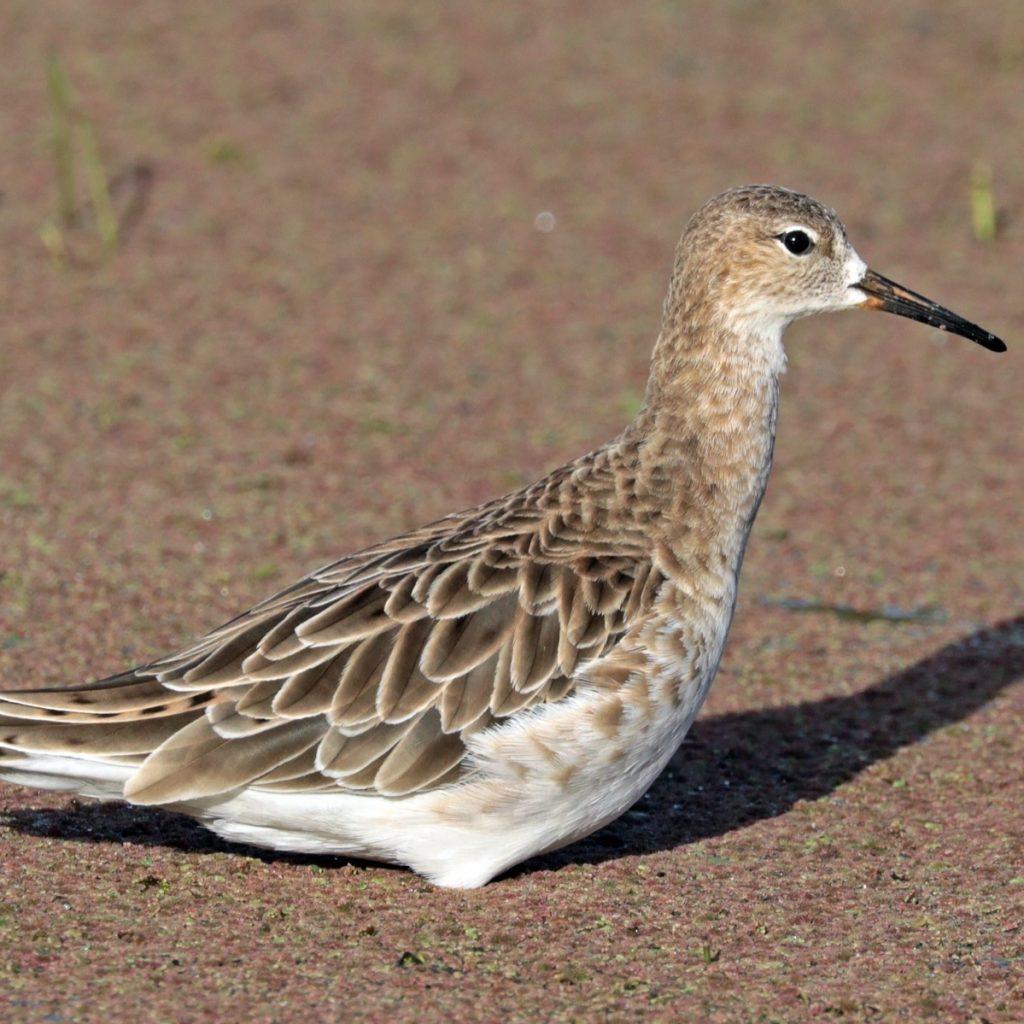
Lake Ziway, on the main road south at Batu, is the easiest waterbird stop in the country. Pelicans and storks feed a few metres from the jetty where the fishermen clean their catch, close enough that a long lens stops being the point. Lake Abijatta-Shalla National Park, further south, holds flamingos on the alkaline water. Lake Langano is the freshwater one people swim in, and the woodland along its shore repays a slow morning on foot.

Bale was inscribed on the UNESCO World Heritage List on 18 September 2023, at the extended 45th session of the World Heritage Committee, under criteria (vii) and (x). The property covers 215,000 hectares and holds Africa's largest area of afro-alpine habitat above 3,000 metres.
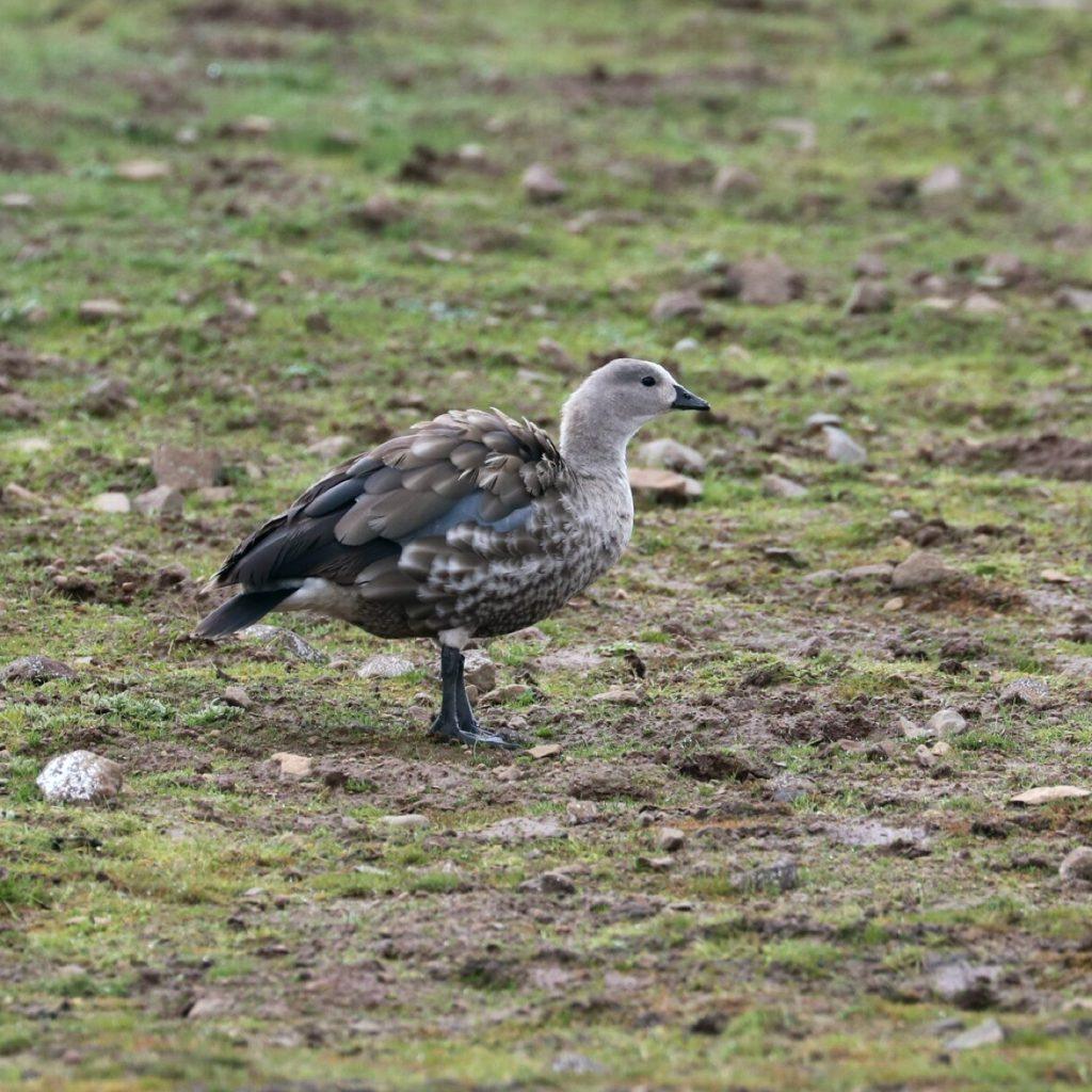
For a birder it behaves as separate sites stacked at different heights. The juniper woodland around the park headquarters at Dinsho holds Abyssinian catbird and black-winged lovebird. The Sanetti Plateau road climbs above 4,000 metres onto open moorland, where blue-winged goose, wattled ibis, spot-breasted lapwing and Rouget's rail are all possible in a morning. Drop off the southern side and you are in the Harenna Forest, which is wet cloud forest and a different list entirely.
Bale also holds the most important population of the Ethiopian wolf, which UNESCO cited in the inscription.
The downside is altitude, and it arrives fast. You climb from the Rift Valley floor to the plateau inside a day. Sleep at Dinsho first if your itinerary allows it, and expect the first morning up top to feel harder than it should.
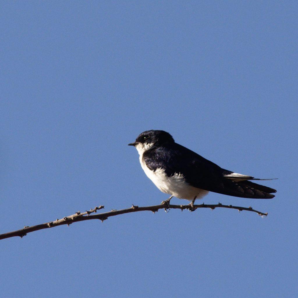
The acacia country around Yabello and Mega, in Borena zone, is the only place either Stresemann's bush-crow or the white-tailed swallow occurs. Both have ranges small enough to draw around on a map, and between them they are the reason the loop carries on south past Bale instead of turning for home.
The Liben Plain outside Negele holds the Liben lark, a grassland bird with a range so small that a bad year on the plain is a bad year for the species. This has always been the hardest leg of the trip. Negele sits well off the main road south, and the drive to it is the part of the itinerary people complain about afterwards.
That changed in 2026. Ethiopian Airlines announced on 18 February 2026 that it would open airports at Negele Borena, Gore Metu and Debre Markos, running thrice-weekly flights to each from mid-April. Negele Borena Geda Airport was then inaugurated on 27 May 2026. Confirm the schedule with the airline before you build an itinerary around it, since the announced start date and the opening date are some weeks apart. The advisory position on Negele is a separate question, and it is below.
November to February is the window you will see quoted everywhere, and for the highlands it is right. FEWS NET's Ethiopia seasonal calendar puts the kiremt rains across the cropping highlands from June to September, and the belg rains from March to May. That leaves the highland sites dry from October through February.
The southern half of the loop runs on its own calendar. For the southern pastoral areas, which is where Yabello, Mega and Negele sit, the same calendar puts the deyr or hageya rains in October to December, and the gu or genna rains in March to May.
Lay the two over each other and only January and February are dry at both ends of the route. A November or December departure is dry in Bale and lands in the southern deyr rains, which is exactly where the unsurfaced roads are.
Palearctic migrants are in the country through the northern winter, so the same months also give you the highest species count. If you would rather have resident birds in breeding plumage and calling, April to September does that, and you will be driving in the rains to get it.
This shapes an Ethiopian birding trip more than anything else on this page, so read it against your own route rather than as a verdict on the country. The FCDO's regional advice for Ethiopia was last updated on 29 May 2026.
The northern endemics are where the problem sits. The FCDO advises against all travel to all of Amhara regional state, which contains Ankober and the Simien Mountains. Ankober serin is the bird most people lose to that, along with the gelada. The FCDO also advises against all travel to Tigray region.
Within Oromia, the FCDO advises against all travel to the area "south and west of the A3 road in North Shewa zone including the A3 road itself in North Shewa". That is the approach to Debre Libanos and the Jemma gorge, which is the day trip birders normally use to pick up a few northern species without committing to the north.
On the southern loop the wording is better and it is specific. The FCDO advises against all but essential travel to "all of East Shewa zone except the Addis Ababa to Adama Expressway and 10km either side of the expressway between Addis Ababa and Bishoftu and the Addis Ababa to Hawassa Expressway". The Rift Valley lakes lie in and around that excepted corridor, so check the exact stops on your itinerary against that sentence rather than against the general shape of it.
For the far south, the FCDO advises against all but essential travel to "West Guji and Guji zones (except the Hawassa to Mega road)". Yabello and Mega are on the excepted road. Negele and the Liben Plain are not, and that holds whether you drive there or take the new flight.
Bale zone carries no advise-against designation at all. The FCDO records that demonstrations have taken place there, and names Shashemene in West Arsi among towns affected by protests, but neither is an advise-against-travel designation and neither should be read as one.
On the Awash leg, the FCDO reports attacks on vehicles travelling on the A1 between Adama and Awash, and states these are "not targeting international travellers".
The US State Department publishes its Ethiopia advisory on a different regional breakdown, and the two do not line up. Read both against your itinerary rather than assuming one stands in for the other. Your travel insurer will usually follow the advisory of your country of residence, which is the practical reason this matters.
The FCDO's safety and security advice for Ethiopia, in the same 29 May 2026 update, says you can use a UK driving licence to drive for up to two weeks, and that driving for longer means applying for an Ethiopian licence through the Ministry of Transport and Logistics. The same page tells you to avoid driving after dark anywhere outside Addis Ababa, because vehicles often have no lights and livestock stray onto the road.
Those two sentences sit awkwardly with how birding actually works. You want to be at the site at first light, which means the drive to it happens in the dark. Someone who knows the road is doing more work on this trip than on an ordinary sightseeing tour.
A 4×4 earns its cost on the Sanetti Plateau road and on anything off the tarmac in Borena. It matters less on the Rift Valley run, which follows the Addis Ababa to Hawassa Expressway for most of its length. Drive Ethiopia rents vehicles both self-drive and with a driver.
| Leg | Ground | What that means for you |
|---|---|---|
| Awash | Hot, low, dry acacia and open plain | Sun cover and more water than you think. Long-range optics earn their weight here |
| Rift Valley lakes | Flat, tarmac, lakeshore walking | Rubber boots for the Ziway shore. Waterbirds come close, so a shorter lens is fine |
| Bale, Dinsho and Sanetti | 3,000 m and above, cold, wind, sudden cloud | Proper layers and gloves. Altitude affects most people on day one |
| Harenna Forest | Wet cloud forest, steep, dark | Waterproofs and patience. Birding is by ear as much as by eye |
| Yabello and Mega | Hot acacia scrub, some unsurfaced tracks | 4×4, and time. Both target birds can take a full day |
| Negele and Liben Plain | Open grassland, remote, basic facilities | Read the advisory wording first. Fuel, water and a driver who knows the plain |
How many endemic birds does Ethiopia have?
It depends on the checklist. Counts built on Avibase's Ethiopia data gave 20 endemics out of 880 confirmed species as of August 2021. Figures in the low thirties are usually counting Ethiopia and Eritrea together, which is how most field guides treat the region.
When is the best time for birding in Ethiopia?
January and February. On FEWS NET's Ethiopia seasonal calendar those are the only two months that fall outside every rainy season at both ends of the route, and Palearctic migrants are still in the country. November and December are dry in the highlands but sit inside the southern deyr rains, which is when the Borena tracks are worst.
Can you see Ethiopia's endemics without travelling north?
Most of them, yes. The southern loop through Awash, the Rift Valley lakes, Bale, Yabello and Mega covers the bulk of the endemic list. Going north adds Ankober serin and the gelada, and as of the FCDO's 29 May 2026 update it means travelling into a region the UK government advises against all travel to.
Do you need a 4×4 for birding in Ethiopia?
For the full loop, yes. The Sanetti Plateau road and the tracks around Yabello and Negele are not saloon-car ground. A Rift Valley lakes trip on its own runs almost entirely on expressway and does not need one.
Can you fly to Negele for the Liben lark?
Ethiopian Airlines announced thrice-weekly flights to Negele Borena from mid-April 2026, and the airport was inaugurated on 27 May 2026. Check the current schedule with the airline directly. Note that the FCDO advises against all but essential travel to Guji zone, excepting only the Hawassa to Mega road, and Negele is not on it.
Is birding in Ethiopia safe?
There is no single answer for the whole country, and anyone giving you one is not reading the advisories. The FCDO's advice is broken down by region and zone, and as of 29 May 2026 the southern birding sites and Bale zone are treated very differently from Amhara and Tigray. The US State Department uses a different breakdown again. Check both against the specific route you intend to drive.
Ethiopia's endemics are easy enough to find once you are standing in the right place at the right hour. The difficulty is sequencing, because the timing, the road surface and the advisory map all have to line up on the same fortnight.
Send us the dates you are considering and the birds at the top of your list. We reply within a maximum of two hours, and you will have a detailed itinerary and a quote within 24 hours. If you would rather start from a route that already works, our Ethiopian birding and wildlife tour runs the full southern loop over 14 days, and our Ethiopia nature tours and Great Rift Valley itinerary cover shorter pieces of it.
Feature photograph: Stresemann's bush-crow by Rafael Medina, CC BY 4.0.
